
Have you ever wondered how your smartphone knows exactly where you are? Whether you are using Google Maps to find a restaurant, booking a cab, sharing your live location with a friend, or tracking a food delivery, your phone can find your location within seconds. It feels almost like magic, but there is actually a fascinating technology working quietly in the background.
That technology is called GPS.
Most of us use GPS every day without thinking about how it works. We simply open a map, enter a destination, and start moving. Behind this simple experience is a network of satellites, radio signals, and smart calculations that help your phone determine its exact location.
In this article, you will learn how GPS works on your smartphone in simple language. By the end, you will understand what happens behind the screen every time you use a navigation app.
What Is GPS?
GPS stands for Global Positioning System. It is a satellite based navigation system that helps devices find their location anywhere on Earth.
The GPS system was first created by the United States for military use. Later, it became available for public use, and today it powers billions of smartphones, vehicles, smartwatches, airplanes, ships, and many other devices around the world.
One of the best things about GPS is that it is free to use. You do not have to pay to receive GPS signals because they are constantly being transmitted by satellites orbiting the Earth.
How Does GPS Work?
The idea behind GPS is much simpler than most people think.
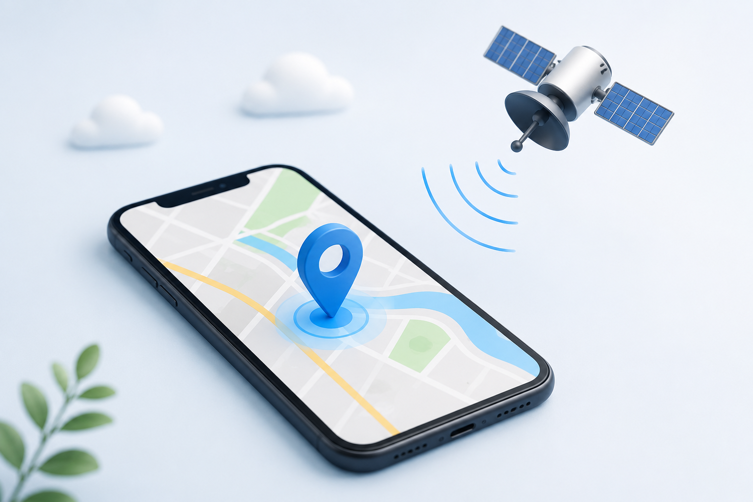
High above the Earth, more than 30 GPS satellites are constantly moving in space. These satellites travel around the planet while continuously sending signals that include two important pieces of information: their exact position in space and the exact time the signal was sent.
When you turn on location services on your smartphone, the phone begins listening for these signals. It collects information from several satellites at the same time.
Your smartphone then measures how long each signal took to reach it. Since radio signals travel at the speed of light, even tiny differences in travel time help the phone calculate how far away each satellite is.
Using information from at least four satellites, your phone performs a mathematical calculation called trilateration. This process allows it to determine your exact position on Earth.
All of this happens within a few seconds, which is why your location appears almost instantly on your screen.
Why Does GPS Need Four Satellites?
Many people believe one satellite is enough to find a location, but that is not true.
Imagine standing somewhere in a large field. If one person tells you that you are exactly five kilometers away from them, you still do not know your exact position. You could be anywhere on a circle around that person.
Now imagine another person also tells you how far away you are from them. Your possible locations become fewer.
When information from four satellites is combined, your smartphone can accurately determine your location, altitude, and correct any small timing errors.
That is why GPS works best when your phone has a clear view of the sky.
Does GPS Need the Internet?
One of the biggest myths about GPS is that it only works with mobile data or Wi Fi.
The truth is that GPS itself does not need an internet connection.
Your smartphone receives signals directly from GPS satellites. These signals are enough to determine your location.
However, apps like Google Maps need the internet for other purposes. They use it to download maps, show live traffic conditions, calculate faster routes, and display nearby places such as restaurants, petrol stations, or hospitals.
If you download offline maps before your trip, GPS can still guide you even without an internet connection.
Why Is GPS Sometimes So Fast?
Years ago, GPS devices often took several minutes to find a location. Today, smartphones usually do it within seconds.
This is because modern smartphones combine GPS with other technologies.
Your phone may also use nearby mobile towers, Wi Fi networks, Bluetooth signals, and built in sensors such as the compass and accelerometer. Together, these technologies help your phone estimate your location much faster while improving overall accuracy.
This is one reason why newer smartphones usually provide a better navigation experience than older models.
Where Do We Use GPS Every Day?
Many people think GPS is only used for navigation, but it has become a part of everyday life.
Whenever you order food, the delivery partner uses GPS to reach your location. Ride sharing services depend on GPS to match drivers with passengers. Fitness apps track your running and cycling routes using GPS. Parents can check the location of family members through location sharing features, while businesses use GPS to monitor delivery vehicles.
Emergency services also rely heavily on GPS. During an emergency, accurate location information can help responders reach people much faster.
Even weather apps, travel applications, and package tracking services use GPS in one way or another.
Without GPS, many of the digital services we use daily would not work as smoothly as they do today.
How Accurate Is Smartphone GPS?
In most outdoor areas, smartphone GPS is surprisingly accurate. It can usually determine your location within three to ten meters.
However, the accuracy is not always the same.
If you are standing in an open field with a clear view of the sky, GPS will generally work very well. But if you are surrounded by tall buildings or inside a shopping mall, the signals may become weaker.
Modern smartphones are becoming even more accurate because they can receive signals from multiple satellite systems instead of relying only on GPS.
Why Does GPS Sometimes Show the Wrong Location?
Have you ever noticed the blue dot on Google Maps moving around even though you are standing still?
This happens because GPS signals are not perfect.
Tall buildings can reflect satellite signals before they reach your phone. This is called signal reflection, and it can confuse your device about your exact location.
Indoor environments also make it difficult for satellite signals to reach your smartphone. Thick walls, underground parking areas, tunnels, and shopping malls often reduce GPS accuracy.
Bad weather usually has only a small effect, but heavy storms and signal interference can sometimes make GPS less reliable.
In most cases, your phone corrects itself within a few seconds as it receives stronger satellite signals.
Does GPS Drain Battery?
Yes, GPS uses battery power because your phone is constantly receiving satellite signals and calculating your position.
If you are using Google Maps during a long road trip or tracking a workout for several hours, your battery will drain faster than usual.
Fortunately, there are simple ways to reduce battery usage. Turning off location services when they are not needed, closing apps that constantly use your location, and enabling battery saving mode can all help extend battery life.
GPS vs Google Maps
Many people use the terms GPS and Google Maps as if they mean the same thing, but they are actually different.
GPS is the technology that tells your smartphone where you are. Google Maps is an application that uses your GPS location to provide maps, directions, traffic updates, and nearby places.
In simple words, GPS finds your location, while Google Maps helps you navigate from one place to another.
Without GPS, Google Maps would not know where you are. Without Google Maps, GPS would only provide your location without showing roads or directions.
The Future of GPS
GPS technology continues to improve every year.
Scientists are working on making location services even more accurate and reliable. Future smartphones may provide better indoor navigation, helping people find shops, airport gates, or hospital rooms more easily.
Self driving cars also depend on highly accurate GPS systems. As this technology improves, transportation is expected to become safer and more efficient.
Artificial intelligence is also being combined with GPS to predict traffic, suggest better routes, and improve navigation based on real time conditions.
It is clear that GPS will continue to play an important role in our daily lives for many years to come.
Conclusion
GPS has completely changed the way we travel, communicate, and use technology. From finding directions and booking rides to tracking deliveries and locating lost devices, it has become one of the most useful features of modern smartphones.
Although the technology behind GPS involves satellites and complex calculations, the basic idea is simple. Satellites continuously send signals, your smartphone receives them, and smart calculations determine your exact location within seconds.
The next time you open a navigation app or share your live location with someone, you will know that your smartphone is communicating with satellites thousands of kilometers above the Earth to make it all possible.
Frequently Asked Questions
Q1. What does GPS stand for?
Answer
GPS stands for Global Positioning System. It is a satellite based navigation system that helps smartphones and other devices determine their location anywhere on Earth.
Q2. Does GPS work without the internet?
Answer
Yes. GPS can find your location without an internet connection because it receives signals directly from satellites. However, apps like Google Maps use the internet to download maps and provide live traffic updates.
Q3. Why does GPS sometimes become inaccurate?
Answer
GPS accuracy can decrease when you are indoors, near tall buildings, inside tunnels, or in places where satellite signals are blocked or reflected.
Q4. Why does GPS use so much battery?
Answer
GPS constantly receives satellite signals and updates your location. Navigation and fitness apps that use GPS continuously consume more battery than regular apps.
Q5. Is GPS and Google Maps the same thing?
Answer
No. GPS is the technology that finds your location, while Google Maps is an app that uses your GPS location to provide directions, maps, and traffic information.