

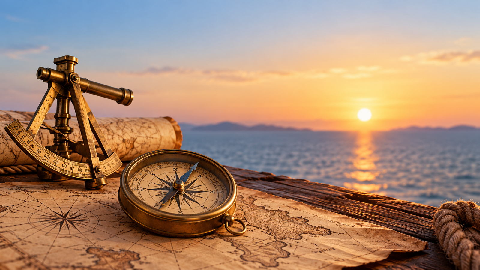
Today, finding a new place is as simple as opening Google Maps on your phone. Within seconds, you can see your location, choose a route, and get directions to almost anywhere in the world. GPS technology has made navigation easier than ever, but people travelled across oceans, deserts, forests, and unfamiliar lands long before smartphones and digital maps existed.
So, how did ancient people find their way without GPS? How did sailors cross vast oceans without losing direction, and how did travellers navigate through places where there were no roads or signboards?
The answer lies in their understanding of nature, the stars, the Sun, and some surprisingly clever inventions. Ancient navigation technology was built around observation, practical experience, and simple tools that helped people understand where they were and where they needed to go.
Many of these techniques may seem basic compared to modern GPS systems, but they played an important role in the development of navigation technology. Some of their underlying principles are still useful today.
How Did People Navigate Before GPS?
Before electronic navigation existed, people depended on their surroundings to determine direction and estimate their position. They learned to recognise landmarks, observe the movement of celestial objects, study coastlines, and remember routes passed down through generations.
Navigation was not always about knowing an exact location. Often, the goal was to find a safe route to a destination and avoid getting lost along the way.
For people travelling on land, mountains, rivers, distinctive trees, and natural pathways served as reference points. Sailors relied on coastlines, wind patterns, ocean currents, and the position of stars. Over time, people developed specialised tools and methods that made long-distance journeys more predictable.
Although these methods required practice and experience, they allowed traders, explorers, sailors, and entire civilisations to travel much farther than their immediate surroundings.
1. The Stars Were the Original Navigation System
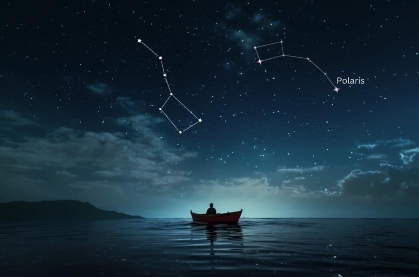
One of thost important navigation techniques used by ancient travellers was observing the stars. Before compasses and digital maps became widely available, the night sky provided a natural reference system that sailors could use to determine direction.
Stars appear to move across the sky during the night because of Earth’s rotation. However, their positions follow predictable patterns. By learning these patterns, navigators could identify familiar stars and use them to help maintain a direction.
In the Northern Hemisphere, the North Star, also called Polaris, has been particularly useful. It appears close to the north celestial pole, making it a reliable indicator of north. Travellers could locate Polaris and use its position to orient themselves during clear nights.
Ancient sailors also learned to recognise constellations, groups of stars that form familiar patterns. Different cultures developed their own systems for using these patterns to navigate across land and sea.
How Star Navigation Worked
Star navigation relied on careful observation rather than electronic calculations. Experienced navigators learned which stars appeared at particular times of the year and how their positions changed depending on where they were travelling.
The process generally involved:
- Identifying familiar stars or constellations.
- Using their positions to estimate direction.
- Observing how the height of certain stars changed with location.
- Combining star observations with knowledge of winds, currents, and landmarks.
Polaris was especially useful for determining direction and estimating latitude in the Northern Hemisphere. However, it was not visible from the Southern Hemisphere, where navigators relied on other stars and celestial patterns.
This method was not as precise as modern satellite navigation, but it helped people travel across large distances when other reference points were unavailable.
2. The Sun Helped Travellers Find Direction
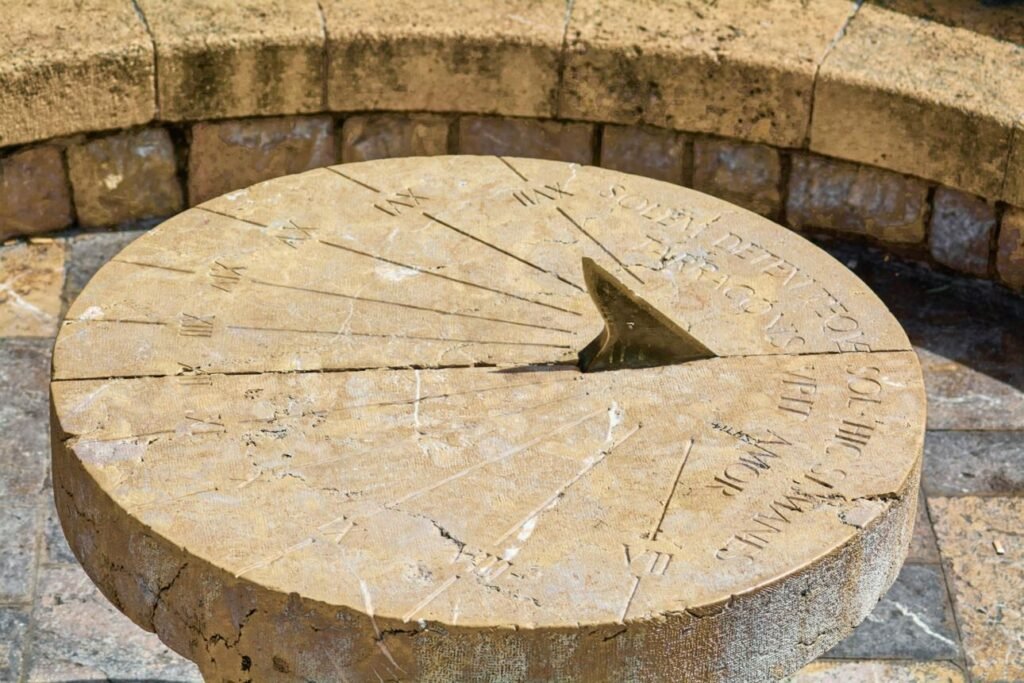
The Sun was another natural tool that helped people understand direction and time. Its apparent movement across the sky gave travellers a useful reference during daylight hours.
In general, the Sun rises in the east and sets in the west. Although its exact rising and setting positions change throughout the year, this pattern helped people establish a rough sense of direction.
Ancient travellers could also observe the Sun’s position at different times of the day. In many locations, the direction of shadows provided additional clues about orientation.
Over time, people developed sundials to measure time using the movement of shadows. While a sundial was primarily a timekeeping device, the observations behind it also helped people understand the relationship between sunlight, direction, and the passage of the day.
Why Sun-Based Navigation Was Useful
Sun-based navigation was especially practical for people travelling on land, where familiar terrain and visible landmarks could support their observations.
However, this technique had limitations. Cloud cover could hide the Sun, and its apparent position varied according to the season and the traveller’s location. Knowing the general direction was useful, but it did not provide an exact position.
Despite these limitations, observing the Sun was one of the simplest ways for ancient people to orient themselves without relying on specialised equipment.
3. The Magnetic Compass Changed Navigation Forever
Observing the stars and the Sun worked well when the weather was clear, but what happened when the sky was cloudy? Travellers needed a way to determine direction even when celestial objects were hidden.
The magnetic compass helped solve this problem.
Early Chinese inventors discovered that certain naturally magnetic materials could align themselves with Earth’s magnetic field. Early magnetic devices were used in China centuries before the compass became a standard tool for maritime navigation. Over time, compasses developed into practical instruments for travellers and sailors.
A magnetic compass contains a magnetised needle that aligns approximately with Earth’s magnetic north-south direction. This allows a person to establish a general direction without needing to see the Sun or stars.
How Did Ancient Compasses Work?
Early magnetic navigation devices were different from the modern pocket compasses we use today. Some early Chinese devices used lodestone, a naturally magnetised form of magnetite. Later compass designs used magnetised needles that could turn more freely.
The basic principle was straightforward: the magnetic element aligned with Earth’s magnetic field, giving navigators a consistent directional reference.
This was particularly valuable for sailors travelling across open water. When coastlines disappeared from view and the sky offered few clues, a compass could help them maintain their intended course.
However, a compass did not tell sailors their exact location. It indicated direction, not distance travelled or the position of their destination. Navigators still needed maps, landmarks, celestial observations, and practical experience to complete a journey successfully.
The magnetic compass was an important step towards modern navigation because it reduced dependence on visible landmarks and clear skies.
4. Polynesian Navigators Crossed Vast Oceans Without GPS
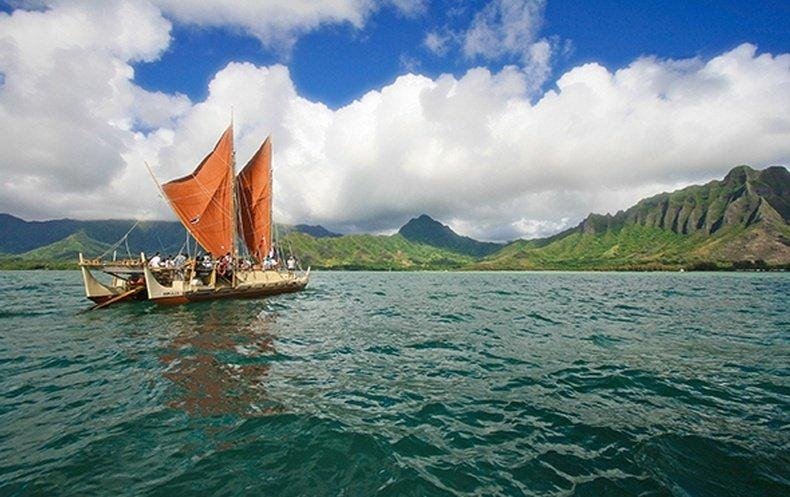
Some of the most remarkable exa
mples of ancient navigation come from Polynesian societies in the Pacific Ocean. Their ancestors travelled between islands separated by enormous stretches of water, using traditional knowledge and observation rather than modern electronic equipment.
These journeys required much more than simply choosing a direction. Navigators had to understand the movement of the ocean, recognise patterns in the sky, and interpret environmental clues that could indicate the presence of nearby islands.
Polynesian wayfinding developed through generations of accumulated experience. Navigators learned from skilled practitioners and passed their knowledge to others through teaching and practice.
The Natural Signs Polynesian Navigators Used
Polynesian navigators combined several sources of information to guide their journeys.
- Stars: Familiar stars and their rising and setting positions helped establish direction.
- Ocean swells: The direction and patterns of waves provided clues about orientation and nearby land.
- Birds: The flight paths and behaviour of certain seabirds could indicate the direction of land, particularly when observed at appropriate times.
- Clouds: Changes in cloud formations and reflections could sometimes provide clues about islands below the horizon.
- Wind and currents: Understanding local weather and water movement helped navigators maintain their course.
No single sign provided every answer. Instead, navigators combined multiple observations and continually adjusted their understanding as conditions changed.
This approach demonstrates an important principle of navigation technology: reliable decisions often come from combining different sources of information rather than depending on just one tool.
5. Ancient Maps Helped People Plan Their Journeys
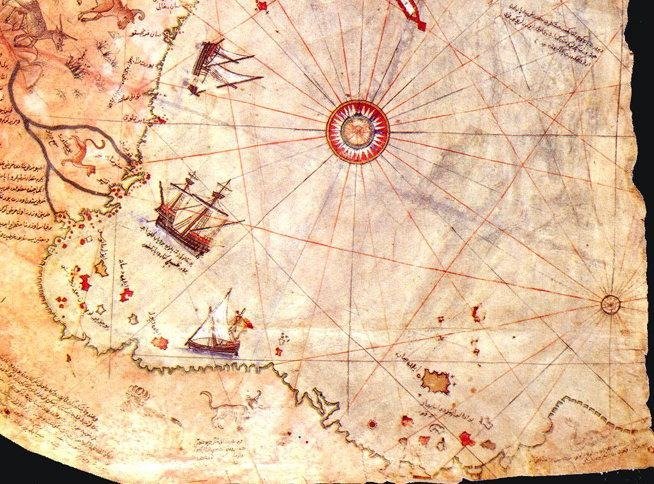
Maps are another important part of navigation history. Long before digital maps displayed live traffic and turn-by-turn directions, people created drawings and records to represent the places they knew.
Early maps were not always accurate representations of the world. Some showed rivers, settlements, trade routes, coastlines, or areas of land that were important to the people who created them. Others reflected the geographical knowledge and beliefs of a particular culture.
As trade expanded, maps became increasingly useful for planning journeys and sharing information between travellers. Sailors could use nautical charts to understand coastlines, identify ports, and recognise potential hazards.
Ancient and medieval maps varied considerably in their accuracy and purpose. Some were practical travel aids, while others were designed to communicate religious, political, or cultural ideas.
How Maps Improved Navigation
Maps helped travellers move beyond relying entirely on memory. They allowed people to record geographical information and share it with others.
A map could help a traveller understand the relationship between locations, identify possible routes, and anticipate geographical obstacles. When combined with a compass and knowledge of local conditions, it became a more useful navigation tool.
Modern digital maps use satellites, sensors, databases, and software to offer much more detailed information. However, the basic purpose remains similar: representing places and helping people decide how to travel between them.
6. The Astrolabe Helped Sailors Estimate Their Position
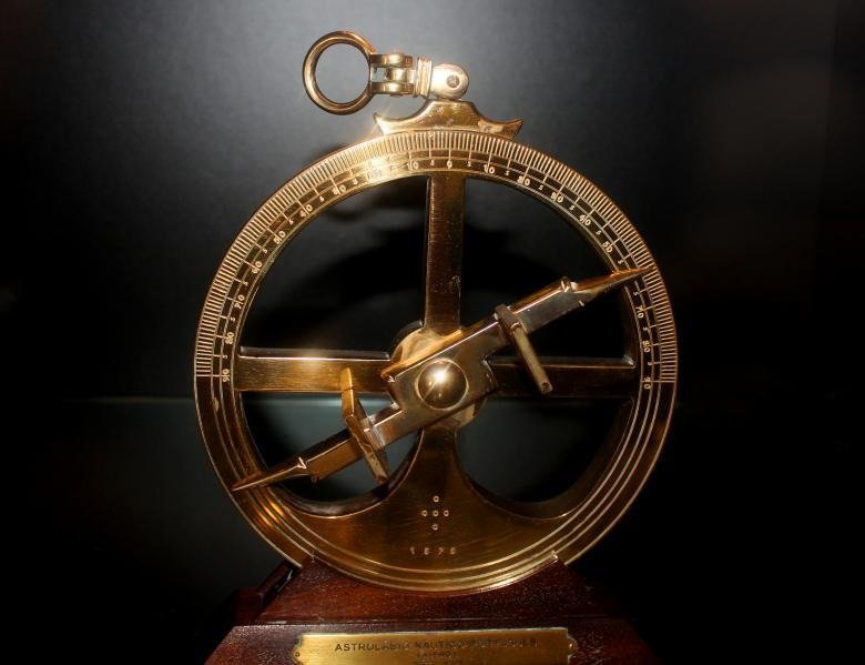
As long-distance sea travel developed, navigators needed better ways to estimate their position. Knowing which direction to sail was helpful, but it was also important to understand where a ship was in relation to the wider world.
The astrolabe was one of the instruments that helped astronomers and navigators study the sky and make measurements.
Astrolabes existed in the ancient Greek world and were further developed by scholars in the Islamic world. Different types served different purposes. The mariner’s astrolabe was a specialised instrument used to measure the altitude of the Sun or a star above the horizon.
By measuring the angle of a celestial object and comparing it with relevant astronomical information, a navigator could estimate latitude under suitable conditions.
Why Was the Astrolabe Important?
The astrolabe represented a move towards more systematic, measurement-based navigation. Instead of relying only on visual judgement and memory, navigators could use an instrument to obtain numerical information.
However, using an astrolabe at sea was not always easy. The movement of a ship, strong winds, and poor weather could make accurate measurements difficult. It also required knowledge of celestial observations and the calculations needed to interpret them.
Later navigation instruments, including the cross-staff, backstaff, and sextant, improved the process of measuring celestial angles. These developments helped make ocean travel more reliable and laid important groundwork for modern navigation methods.
7. Dead Reckoning Helped Travellers Estimate How Far They Had Gone
Not every navigation method depended on looking at the sky. Travellers also needed a way to estimate their current position based on where they had started and how far they had travelled.
This technique is known as dead reckoning. It involves estimating a new position using a previously known position, the direction of travel, and the distance covered over time.
For example, imagine a sailor leaves a port and travels west for several hours. If the sailor knows the approximate speed of the ship and the direction it has been moving, they can estimate how far the ship has travelled and where it might be.
Historically, sailors used information about a ship’s heading, speed, and time underway to estimate their position. They also had to account for factors such as currents and wind, which could push a vessel away from its intended route.
The Limitations of Dead Reckoning
Dead reckoning was useful, but errors could build up over time. A small mistake in estimating speed or direction could lead to a significant difference between the calculated position and the ship’s actual location.
To reduce these errors, sailors regularly checked their estimates against other sources of information, such as celestial observations, coastlines, and known landmarks.
The same general principle is still used in modern navigation. Aircraft, ships, and navigation systems can estimate movement between reliable position updates. The methods and equipment are more advanced today, but the underlying concept remains relevant.
8. Landmarks and Local Knowledge Were Essential for Navigation

Not all ancient navigation involved long ocean voyages. Most people travelled shorter distances on land, and their navigation methods often depended on detailed knowledge of the surrounding environment.
Mountains, rivers, valleys, distinctive rock formations, and established paths could help travellers recognise where they were. People learned which routes connected settlements, where rivers could be crossed safely, and which paths were suitable during different seasons.
In unfamiliar regions, local guides were particularly valuable. Their knowledge could help travellers avoid dangerous terrain, locate water sources, and choose the safest available route.
This kind of navigation depended on memory and experience rather than a single piece of equipment. Information was passed between generations, allowing communities to develop detailed knowledge of their local geography.
Landmarks were also useful to sailors travelling near coastlines. Recognising a headland, harbour entrance, or mountain range could help a ship’s crew confirm its position and approach a destination safely.
Even today, people use visible landmarks to confirm directions when travelling through unfamiliar places. The tools have changed, but the basic idea remains the same.
9. How Ancient Navigation Techniques Compare With GPS Today
Ancient navigation methods may appear simple compared with modern technology, but each solved a specific problem. Some helped people determine direction, others helped estimate location, and many worked best when combined.
GPS, or the Global Positioning System, uses signals from satellites to calculate a receiver’s position. A GPS-enabled device can estimate its location by measuring the timing of signals received from multiple satellites. It can then combine this information with digital maps and route-planning software.
The biggest difference is that ancient navigation depended heavily on human observation and interpretation, while GPS automates much of the process.
| Navigation method | Main purpose | Main limitation |
| Stars and constellations | Determine direction and estimate latitude | Requires suitable visibility and knowledge of the sky |
| Sun and shadows | Establish rough direction and track time | Affected by clouds, seasons, and location |
| Magnetic compass | Identify magnetic north and maintain a heading | Does not provide an exact position |
| Polynesian wayfinding | Navigate across the ocean using environmental clues | Requires extensive training and experience |
| Maps and charts | Record places and plan routes | Accuracy depends on the available information |
| Astrolabe | Measure celestial angles to help estimate latitude | Requires suitable conditions and skill |
| Dead reckoning | Estimate position from direction, speed, and time | Errors accumulate without position checks |
| GPS | Calculate position using satellite signals | Can be affected by signal obstruction, interference, or equipment problems |
Modern navigation is much faster and more convenient, but it still benefits from the same basic ideas developed over centuries: measuring, observing, recording, and checking position.
10. Do We Still Use Ancient Navigation Technology Today?
Although GPS has transformed the way people travel, several principles behind ancient navigation are still used in modern systems.
For example, aircraft and ships can use celestial navigation as a backup when electronic systems are unavailable. Magnetic compasses remain useful for outdoor activities, boating, and emergency situations. Maps and charts continue to support navigation, while dead reckoning helps estimate movement between known positions.
Modern technology has not made every traditional method useless. Instead, it has improved many of the same techniques through automation, better measurements, and faster calculations.
There is also an important lesson in how ancient navigators worked. They rarely depended on just one source of information. They combined observations, checked their assumptions, and adjusted their decisions when conditions changed.
This approach is still valuable today, especially when technology fails or the information provided by a digital device needs to be verified.
Conclusion
Before GPS, navigation was a combination of observation, experience, scientific understanding, and practical problem-solving. Ancient people used stars to determine direction, the Sun to understand orientation, magnetic compasses to maintain a heading, and maps to record geographical knowledge. Skilled navigators also learned to interpret ocean swells, winds, birds, and other natural signs.
These techniques helped people cross oceans, establish trade routes, explore unfamiliar territories, and connect distant communities. They also contributed to the development of more advanced navigation instruments over time.
Today, GPS can calculate our position in seconds, but it builds on a much longer history of humans trying to understand where they are and how to reach their destinations.
The story of navigation is a reminder that technology does not always begin with computers or electricity. Sometimes, it starts with observing the world, recognising patterns, and finding a smarter way to solve a problem.
Frequently Asked Questions
Q1. How did people navigate before GPS?
Answer: People used stars, the Sun, magnetic compasses, maps, landmarks, and natural signs to find their way. Sailors also used ocean currents, wind patterns, and techniques such as dead reckoning to estimate their positions during long journeys.
Q2. What was the most important ancient navigation tool?
Answer: There was no single tool that worked best in every situation. The magnetic compass was especially valuable because it helped people determine direction even when the Sun and stars were not visible. Celestial navigation and maps were also important for long-distance travel.
Q3. Did ancient sailors cross oceans without compasses?
Answer: Yes. Polynesian navigators crossed vast stretches of the Pacific Ocean using stars, ocean swells, winds, birds, clouds, and detailed environmental knowledge. Their journeys demonstrated how skilled observation and knowledge passed between generations could support long-distance navigation.
Q4. Is ancient navigation technology still used today?
Answer: Yes. Magnetic compasses, maps, celestial navigation, and dead reckoning remain useful in certain situations. Modern navigation systems also rely on related principles of measurement and position estimation, although they use more advanced equipment and calculations.